| Report Type | Full |
| Peak(s) |
Emerald Peak - 13,916 feet Mt. Harvard - 14,424 feet Mt. Edwards - 13,860 feet French Mountain - 13,942 feet Casco Peak - 13,905 feet Mt. of the Holy Cross - 14,007 feet Holy Cross Ridge - 13,850 feet Rio Grande Pyramid - 13,825 feet Snowmass Mountain - 14,105 feet Hagerman Peak - 13,848 feet |
| Date Posted | 10/09/2026 |
| Date Climbed | 04/05/2026 |
| Author | notidealbutfine |
| Quest to 100 / Part 6: The Spring Reawakening: Snow Slogs and Lollipops Galore / #72 to #81 |
|---|
|
From my blog: https://notidealbutfine.wordpress.com/ Quest to 100 - Part 6: The Spring Reawakening: Snow Slogs, Ski Regret and Lollipops Galore - #72 - #81 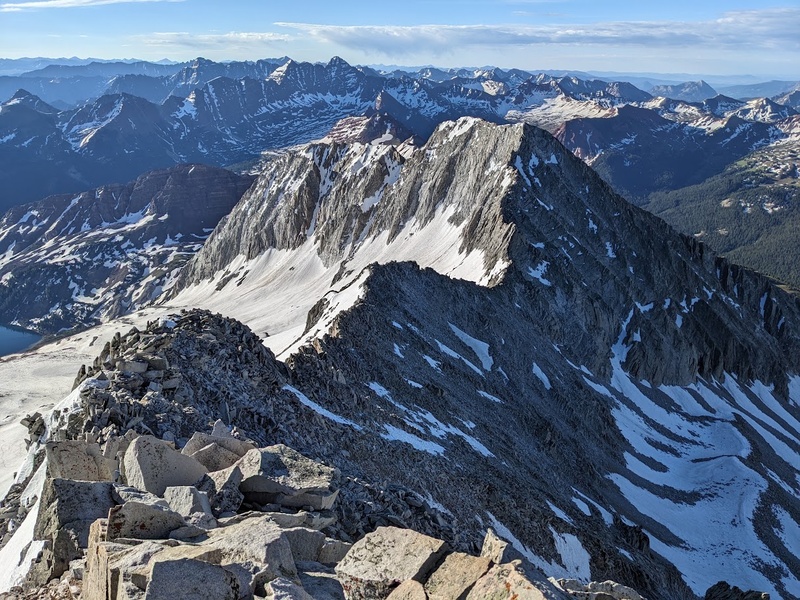
Finally, after a virtually nonexistent, disappointingly dry winter winter season in the Rockies, as it always does, the darkness finally gave way for the light of spring to reawaken once again, and with it, rejuvenating my spirit for the Quest upon this introspective one-year anniversary. Last year, on the spring equinox of 2025, I had declared and begun to climb my remaining 88 Centennials, thus resulting in the inception of the Quest. For me, anniversaries (and winter hibernations) are always an exquisite opportunity for reflection and the resetting of intentions and perspectives. Like anything else, it's certainly possible to love something to death. On the contrary, distance does indeed make the heart grow fonder and I can't help but to feel both of these statements truly embody my overall experience of reawakening from winter to spring this year. While the nonstop nature of last season had me ready and willing to take a break from the mountains, that very break was piloting the spaceship of stoke and motivation leading into the future of warmer weather and longer days. Paradoxes like this would come to be a major theme for the remainder of the Quest, seemingly bashing their head against mine until I could process them in hindsight. So, after a nearly three-month break from the Centennials semi-absently filled with below-average backcountry skiing, manic writing sessions, backpacking and tooling around the dunes, the fire for the 2026 season was born once again from the ashes of winter's darkness and with it, the reignition of the Centennial spirit, in layman's terms, to: "Get the heck back out there!". This season we're looking at some extra long snow slogs in the Sawatch, zero ski descents whatsoever, some seriously exquisite trekking in the Weminuche and finally, wrapping up with one of the most sketchy, technical and truly uncomfortable ridge traverses I've ever had to swallow solo. As always, thanks for reading and please enjoy as we embark on what it feels like to suffer up some high peaks after eating nothing but Christmas cake and super doughnuts for the past two months. Have fun and stay safe out there! My CalTopo Map: https://caltopo.com/m/KS1MKP5 4/5/26 "Spring Quiet in the Sawatch (feat. a Whole Lotta Gain)" 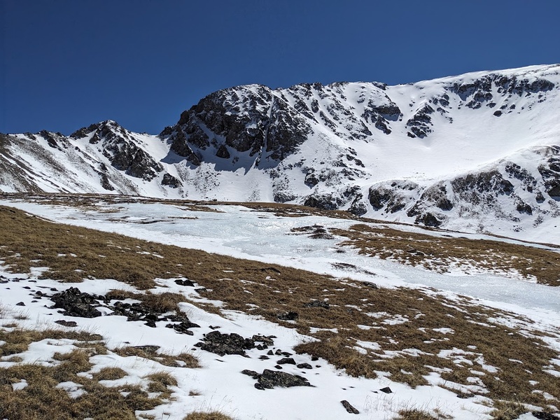
In comparison to last year, snow conditions in the mountains seemed to be about a month or more ahead of schedule. Snowpack was decent in the high basins, but patchy near and below tree line, thus giving me almost no confidence for a consistent ski that was more than a couple miles. I love truly skiing but especially after a day like Yale last spring, I can very much recognize I'm not a "shlep your skis 7 miles to ski 1" kind of guy. As a result, I packed up my snowshoes and additional cold weather gear for a couple days in the Sawatch as a quiet and chill way to kick off spring. Sunday morning, I made it to the Missouri Gulch TH around 6:45AM to get started with the Emerald/Iowa combo, joined only by two other cars in the lot, seemingly to climb Belford. What a great reminder that shoulder seasons are truly the best. After suffering up the first 800 feet of steep switchbacks, I quickly made it to my previous camp in the lower basin which was surprisingly packed in with snow to just below Elkhead Pass. Morning views of majestic Missouri made this section fly by, even though my feet were soaking and freezing by the time I had post holed in my sneakers to the top of the pass. From Elkhead, I switched socks, changed from trail runners into mountaineering boots, and strapped on those snowshoes as the descent and remaining climb up and out of the Emerald basin was completely blanketed in snow. For fun, let's start up the "should have brought skis" counter at one here and see how many we can add up this spring. As I moved towards Emerald, truly amazing views of Harvard's north face came into view, which was a big stoker for tomorrow, as I'd be climbing Harvard from North Cottonwood. Overall the snowshoeing to the base of Emerald's dry ridge was not too bad considering I was breaking trail from here on out. Surprisingly, the snow was still quite firm and supportive in the cold morning. From the base of the ridge, I dropped my snowshoes and pack for the final few hundred feet to the summit. Upon reaching the peak, that glorious feeling of being atop a mountain for the first time in months all came rushing back in, as did the dread of the remaining gain up Iowa and reascent of Elkhead Pass to get back into the Missouri Basin. So as per usual, I spent virtually no time on summit before working my way to Iowa and heading back down, in futile hopes that if I moved quickly the snow would continue to stay supportive on the way back. Spoiler alert: it didn't and the slog through the basin and reascent of Elkhead was relatively miserable, however self-imposed by leaving at the late time of 6:45AM this morning. By the time I reached the top of the pass on the descent, I was exhausted and soaked, but truly thankful for the sunny, perfect weather and the opportunity to give a lot of effort in exchange for a beautiful spring day in the mountains with zero crowds whatsoever. Spring truly is absolutely serene and peak season in the mountains regardless of the slog. Anyways, back to the car and Harvard ho tomorrow! 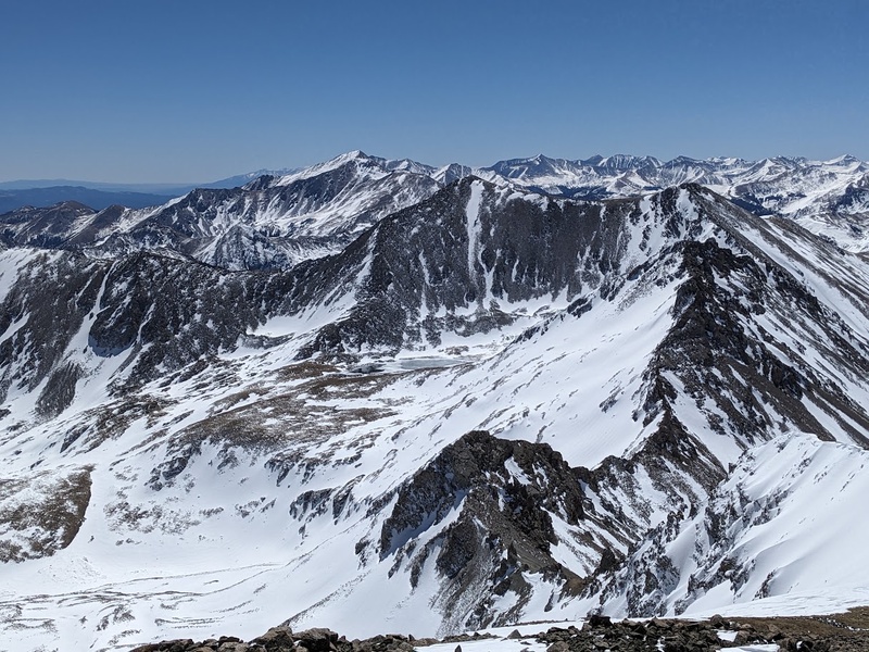

4/6/26 "A Worthy Goal for a Long Slog in Wet Boots and Snowshoes" 
After Emerald/Iowa, I changed into sandals and new clothes since my socks, boots and trail runners were completely soaked from the sloppy descent. While I drove to the North Cottonwood TH, I tried to dry my gear with the car heater on full blast but by the time I arrived, everything was still pretty wet. I had four extra pairs of socks on me, but wet shoes and boots on a long 14er day in spring gave me plenty of hesitation. Ultimately, I figured I would at least give it a go since Harvard/Columbia had thwarted me in the past in addition to being already camped here for the evening. The shoes hit the trail around 4:45AM the next morning as I followed a nicely bootpacked trail through the forest, crossing the creek a couple of times before the pack stopped around 2.5 miles into the trail. Silly, silly me to get my hopes up that someone else had slogged all the way up Harvard recently! From here, I switched into those cold, wet mountaineering boots and snowshoes and continued up the basin until just before tree line, glorious Harvard burst upon the horizon, bathed in golden morning light; oh glorious spring views once again! The views on this hike really brought back memories of the approach to Handies east face in the early morning light. Still in the bottom of the basin, I followed the frozen waterways on snowshoes to the base of the south facing shoulder leading to Harvard's main slopes. Luckily, the rest of the route looked totally dry, so I took a break to ditch my gear, eat some snacks, and chill out before the final push. The rest of the climb up Harvard's south slopes was mostly dry with some short sections of post holing and, even though quite steep, went relatively quickly. For being the 3rd tallest 14er in Colorado, I never really felt the imposition of it being totally never ending. After some short, fun rock scrambling on the final few hundred feet, I stood upon Harvard's glorious summit on this heavenly clear spring day. The view was dominated by a fantastic panorama of the basin and Columbia looking extra mean in the shadowy hard light. And again, wow is it nice to be up on a popular 14er totally by yourself. These are the kinds of summit experiences I live for, though I certainly could have lived without the sopping wet boots and seemingly endless miles of snowshoeing. Alas, that's the reality of spring in the mountains. My final futile thought before I began my descent off the summit of Harvard was one that would become increasingly common this spring: "Fuck, I should have brought the skis." (set the counter to two) 

4/12/26 "One of the Most Unremarkable Centennials on the List" 
Willy K and I had planned to get out to French/Casco this Sunday, but a windy forecast had us pivoting to Edwards/McLellan since it was looking much nicer in the morning. William offered to drive the Jeep so we left the SLV around 4AM and began our hike up Edwards around 8:20AM. The 3.5 miles on the 4WD approach road were some of the roughest I'd driven before so I was incredibly thankful to be in the Wrangler since my little car would have surely not made it beyond the first quarter mile. From the Waldorf Mine, we parked the car and moved on foot directly up the east slopes towards Edwards. No approach on this one if you drive the road; it reminded me vividly of many of the climbs in the Mosquito/Tenmile area as you could park close to or above tree line and have a very short day. The main weakness on the east slopes was snow filled, but completely avoidable due to easy terrain all around. Though a potential ski would have been pretty short, the overall hike was incredibly short as well, leaving me cursing I left them at home again. Make that 3 for skis and 0 zero me. Before we knew it, we were on top of the saddle between Edwards and McClellan taking in the awesome views of Torreys. From the saddle we quickly bagged Edwards then McClellan up their incredibly unnoteworthy talus slopes. Though the climbing was about as uninteresting as it gets, the views of close by Grays and Torreys and distant panoramas of Blue Sky, Bierstadt and the sawtooth were the highlight of the trip, bringing back all those memories of my good times on these peaks. Overall, Edwards was as unremarkable as they come, but I'll take wins where I can get them and good times in the mountains with friends any day. My suggestion if I were to do it again would be to combine it in a day with Grays and Torreys for the maximum amount of juice to squeeze. 
4/25/26 "Insert Comment About Additonal Sawatch Peak Here" 
Boy, there sure are a lot of class 2 Sawatch hikes on the Centennial list! Not that I don't enjoy them. Quite the contrary, it's nice to have some easier stuff that you know quite well when conditions are not ideal for climbing more technical routes. They are always a bit of a fallback, but that's never necessarily a bad thing. French and Casco would be my final "easy" spring peaks before some of the other class 2 stuff opens up around the state, including RGP, Holy Cross and some of the Centennials by Lake City. The forecast had a nasty looking spring storm rolling in later in the weekend, so I left Saturday night and camped at the unofficial trailhead at the turnoff of FR110J so I could get a head start before the bad weather rolled in. After a slow morning of sipping real (not instant) coffee, I got started on trail around 5:30AM. Apparently, I had learned nothing of my later starts in the previous months, hoping that there wouldn't even be that much snow to have to stay on top off, but alas, lessons are learned slowly in this old noggin. The first few miles up the trail went quite easily as it followed an old Jeep road almost all the way to the base of the climb. The road was interspersed with snow drifts here and there (reminding me a lot of Yale again), so, for the first time this spring, I was thinking I was quite happy to have not brought the skis so far. After 4 miles, I bushwhacked a short distance to the base of French Mountain's dry south face where I began the totally uneventful slog up the talus slopes ala Mount Massive southwest slopes. From the top of French, I switched into boots, crampons, and an axe since there were some quite runout slopes to cross on the traverse over to Casco, finally adding a bit of spice to a generally totally average day. The traverse would have been quite sketchy without the gear so I was happy to have lugged it all this way. After topping out intermediary Frasco Benchmark and tackling the final snow climb up Casco, I found myself on summit around 10:30AM looking down on what would come to be the best glissade of my spring season, making it down about 2,000 feet in a matter of minutes. We'll give the skis a half point on this one since I was only mildly sad with my gear choices today. Despite my later start time, I managed to beat the incoming storm and had a nice and easy descent on surprisingly supportive snow, capping off the quite average day with a nice aftertaste. 

5/31/26 "One of the Most Epic Alpine Ridge Cirques Among All the 14ers" 


Lately, I've been seeing reports online that Tigiwon road (the approach for Holy Cross) was open a month early this season due to dry conditions. Honestly, I had been slightly dreading Holy Cross a little bit due to either climbing it in the swarm of crowds in summer, or having to approach that 8.5 mile road on foot before it opens in the spring. Now was the time to get after it! It seemed most folks were either not aware the road was open early or weren't willing to get out in late May due to the lingering amount of snow still on the mountain, resulting in a nearly empty parking lot on a Sunday camp/Monday climb. Cozy camping in the woods, hot coffee in the morning and bathrooms at the trailhead made for one of the best starts to a Centennial this season! Boots hit the ground about 4:00AM as I was off onto the Fall Creek trail to lollipop the Halo Ridge on the way up and standard route for the descent. The approach below tree line was straight forward and relatively snow free, as were the switchbacks up the face leading out of tree line to the high point between the notch and Point 13253. Upon topping out the high point, the views of the magnificent Cross Couloir and upcoming ridge traverse were truly an incredibly breathtaking sight to take in. The Halo Ridge is wonderfully scenic and stylistically right up my alley for what I enjoy climbing. Much like Columbia, you just stay on the ridge crest as you make an epic alpine cirque of the two 13ers along the way before bagging Holy Cross Ridge and Holy Cross proper. Truly stunning views of the Tuhare Lakes, the Bowl of Tears and nearby Elks and Gores had me smiling the whole way up. On the final summit, I met up with another climber who had tackled the Cross Couloir, who I'm pretty sure was the only other guy on the mountain today. The north ridge on the way down held a lot more snow than Halo, mostly due to aspect, but was an incredible way to see this entire ridge from top to bottom. Despite no real scrambling of any kind, these are the kinds of days in the mountains I live for. Holy Cross is truly the crown jewel of the Sawatch and I would highly recommend this specific route if you want to get the full value out of this gem of a 14er. 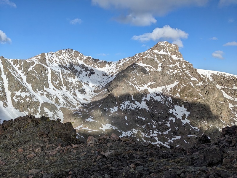

6/6/26 "Pure Wilderness Isolation, Endless Amounts of Variety and Quite Possibly the Best View Atop Any Mountain in Colorado: Hands Down the Definitive Centennial Experience" 
Finally after Memorial Day weekend, the road to the 30 mile campground near Creede, which gives access to the standard route on RGP, is open for the season, which meant it was time for a good ol' college try on what would be the longest mileage day of the Quest. Originally, I had planned to climb RGP during my birthday weekend last fall, but pivoted to Phoenix Peak due to limitations of the car I was driving at the time. After much deliberation, I had landed on a plan to hike RGP in a single push from the car as opposed to backpacking. Since the first five miles below the turnoff to the Skyline/Opal trail were relatively flat, I knew I could get this done fast by running the majority of it on the way up and down and would probably result in a whole heck of a lot less effort than hauling camping gear up that far. As it would be, I drove out to the Rio Grande Reservoir Friday evening, found a private campsite just a couple miles away and tucked in for a nice camp before embarking on my big day in the Weminuche. After a disproportionately large breakfast with far too much coffee and a whole lotta doughnuts, I got started moving up the first 5 miles of the Weminche trail as the full moon illuminated the way forward. Over caffeinated and over caloried, I rapidly made it to the first creek crossing and turnoff where the route leaves the main trail for a snack break and water squeeze. Past the hidden turnoff, the trail climbs and eventually peters out as you traverse below the ridge moving west. Though there was a little bit of willow thrashing on the way up through the upper basin, the route was very nice, offering up tons of variety and absolutely signature views of RGP and the window on the approach. I made it to the base of the climb around 9:00AM, then to the summit about a half hour later. While the actual climb up RGP was quite honestly an unremarkable talus trundle, the prominent and jarringly isolated view from the summit was truly one of the most memorable and awe inspiring of all the Centennials thus far. What a treat it was so sit on summit and reminisce about my days on some of the high peaks I could see from here such as Handies, Sunshine, Redcloud, Uncompahgre and Wetterhorn, as well as to get stoked for all the San Juan behemoths that lie in wait: the Chicago Basin 14ers, Turret and Pigeon, the Trinities, Grenadiers, Wilsons, Sneffels, Jones group, and Half Peak. Wow, could you see it all up here on this unbelievably clear day! The summit (and entire trip) was absolutely dead quiet, isolated and immensely beautiful, instantly making the Weminuche one of my favorite spots in Colorado, and I hadn't even been to the best parts yet! On my way down, I took the quick route down by connecting back with the CDT low in the basin by cutting through some nasty willows. Once back onto a solid trail, I ran the rest of the way out and made it back down to the car in about 3.5 hours, making for a much lower effort day than I was planning on, mostly due to the lack of any serious gain to get up RGP. If you're looking for a signature Centennial experience, without a doubt, hands down, Rio Grande Pyramid is the goat. 
6/13/26 "Maybe There's a Reason Nobody Does This Traverse..." 
After much deliberation of whether to head to Lake City or hit Snowmass/Hagerman, I finally decided to finish up the Elks and go for Snowmass while the snow was still good to climb. Originally, I had planned to hike Snowmass via the nonstandard western approach from Marble, mostly due to lack of crowds and the possibility of a dry climb, but after examining the recent satellite photos from CalTopo, it seemed as though there'd be quite a bit of snow climbing regardless of which side I started on. Not to mention, Snowmass is such a signature 14er, I thought I'd be missing out on the right of passage that is approaching it from the east via Snowmass Lake. Being the cheap dirtbag that I am, I didn't secure a permit to camp at the lake so I made my way six miles up the Snowmass trail and made camp at the last legal, free dispersed campsite just before the log jam, much like how I approached Capitol. The first six miles felt like a signature Elks approach, featuring a lot of gain on a trail that follows the creek through a dense mix of aspens and pines. With the exception of the swarming mosquitos, camp was cozy and very private. 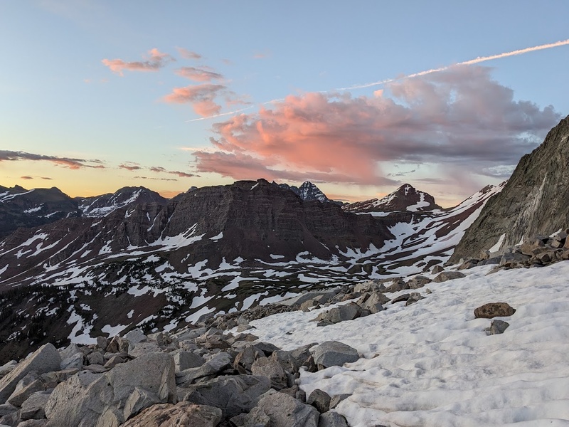
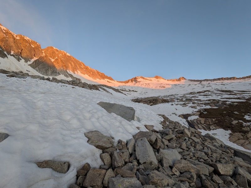
I managed to get an early start at 3AM the next morning, particularly motivated to get up and down the large mass of snow on the east slopes while the getting was still good and before the whole slope turned to slop. By 4AM, I made it to Snowmass Lake and was traversing the intermittent snow banks on the northern aspects of the banks just below the base of the climb. To my surprise, the semi-infamous talus slopes below the snowmass were not nearly as bad as I had anticipated and managed to make it to the base of the snow by around 6AM, where I changed into my snow climbing gear for the next step on route. With an axe, boots and crampons, the ascent up the signature east slopes felt chill, safe and fun especially due to hitting the timing perfectly for some seriously solid climbing snow. The angle kicks back a little bit steeper just below the saddle, but nothing ever felt like you were going to fall off that thing. From the saddle, I changed back into trail runners and spikes and made quick work up the dry class 3 ridge to the top of Snowmass, managing to be the second person on the summit that day. The views from the summit of Snowmass were also incredibly memorable especially looking towards the epic Satan's Ridge that connects Capitol to Snowmass. Just when I thought my jaw couldn't drop any further, I turned around and got my first look at what was to come next: the grossly loose and perverted ridgeline that is the infamous Snowmass/Hagerman Traverse. 

Certainly a few memories drum up when I knock the ol' noggin thinking about the feeling of losing your lunch when gazing up a route you're about to get on. The exposure on The Prow on Kit Carson first comes to mind, followed by the narrow ridgeline that is the Thunder Pyramid Traverse. As I descended towards the Snowmass/Hagerman saddle and looked up at the initial tower and subsequent insanity, I seriously thought to myself: "Maybe there's a reason there's virtually no beta on this traverse online...". Terrifying, steep and chossy, the imposing ridge leading to the next objective felt consciously oppressive and gut wrenching. I couldn't help but to think, fuck, was I really about to get on this? It's one thing to give this a go in summer conditions when the rock is totally dry, but it's absolutely different beast when you're hauling a hefty 55L pack with your mountaineering boots, crampons and axe on your back while trying to navigate the steep choss and ice covered slabs on the west side of Hagerman. Again, I was faced with another do or die moment (literally), a feeling I was unfortunately becoming a little too familiar with after much time in the Elks. I lingered around the saddle for some time, asking every rando making their way up Snowmass if they had any plans to traverse to Hagerman and if they could fill me in on any beta they'd know. To my (honestly quite expected) dismay, I was primarily met with dead stares, accusations of bullshit and newer climbers that looked like they were gonna shit their pants on their way up the class 3 ridge to Snowmass, so I knew I was completely out of luck for any kind support on this one. To my own stubborn dismay for having to drive all the way out here again, I futilely psyched myself up and made the quite irrational choice to get on it and see if it goes... From the two reports I could find online of folks attempting this traverse, the common theme is to drop down onto the west side of the ridge, stay low and find a way up Hagerman somewhere at or near the standard west slopes route, so I thought I'd give that a try since the initial tower just above the saddle looked like it could crush your soul into pieces. As a result, I reluctantly dropped down a few hundred feet, locked in and started traversing southeast on the dark side of the mountain. The route across Hagerman's west face felt somewhat similar to the standard route on Crestone Needle: crossing over multiple dips and ribs in the rock before ultimately deciding where to make the final push to the top. While the dips were filled with dripping ice and chossy crap, the elevated ribs were honestly just as horrifying, having to tackle loose slab climbing while navigating around the wet spots on a thin crest. I passed over three of these ribs, made my way into the final dip and onto the fourth rib before realizing that this final rib to the top was FAR too steep and loose for me to want to attempt without a rope, partner or approach shoes. The dip between the fourth rib and the west slopes route also looked impassable, unless I wanted to drop down an addition 1000+ feet to the basin floor. Once again blinded by my stubbornness to never lose elevation gain whenever possible, I carefully backtracked my way over the icy dip back to the third rib, sized it up and ultimately decided to give it a go, as it was looking far better than where I had been previously. As I begun the final 500 foot section on the third rock rib to the summit, I couldn't help but notice I was hyperventilating, obsessing over negative thought spirals, and overgripping the absolute shit out of the rock, so I decided to chill for a few minutes while I was in a good position to gather my marbles, give myself a pep talk and calm my mind. I actually have a difficult time vividly remembering the following 20 minutes to the top I was so locked in and focused, but my journal from the day after recalls "5.5 or 5.6 slab, terrifying, wet, loose and extremely engaging, followed by blocky volume climbing just before the top.". Almost like I was abruptly plucked from the sky by the gods themselves, I found myself on top of Hagerman, hyperventilating once again and physically laughing out loud as an insane person recovering from denial would. I dreadfully turned back around to look down at the work I had just done and the immediate thought that enter my brain was: While I certainly had not planned for it to go this way, I desperately scanned the basin looking east/southeast for an improvised escape plan and was blessed to see the obvious trail moving up Trail Rider Pass. Tapping into my faded memory, I recalled Trail Rider Pass is part of the famous Four Pass Loop, which I knew ultimately met back up with Snowmass Lake further down the trail. Though it'd require some off trail, semi-heinous scree side hilling, I knew for a fact I could connect the standard west slopes route on Hagerman to the base of Trail Rider Pass. Proceeding my semi-traumatic improvised ascent up Hagerman, I felt an incessant urge to get off that damn thing as fast as possible and get back onto safe terrain, where I would finally take a break and reflect. It felt easier to keep moving and stay focused instead of trying to digest this entire abominable experience while I was still trying to descend the loose route. After much controlled falling and swearing my way down the west slopes, I traversed off trail to the base of the pass, climbed up and made a quick and safe descent back down to my camp below the log jam, where I unexpectedly dozed off for the night due to the sheer mental exhaustion of putting myself through that. 
So, would I recommend the Snowmass/Hagerman Traverse to other experienced climbers looking to bag the Centennials via super efficiency? To be honest, not unless your sick in the head and love feeling like you're gonna die. Seriously, this one was no joke by any wild definition of the word. That being said, much like many of my other adventures on some of these butt-puckering traverses, it was one of those pivotal watershed moments I had to put my skills to the test in the most extreme of settings and honestly evaluate my climbing and how much risk I'm willing to take on. Almost like clockwork, I'm faced with yet another paradox of the 100: while I never really go out of my way put myself into these kinds of traumatic situations, it's these very situations that enable us to grow as climbers, recall previous experiences to draw upon for future climbs, and cultivate some of the most unforgettable and truly character defining experiences in the mountains. Would I do it again? Honestly, no. I think I'd take a pass on this one... Anyway, cheers, Hagerman and fellow Elks! Thanks for the vivid reminder of what it feels like when you're gonna shit yourself from fear of instant death from below! 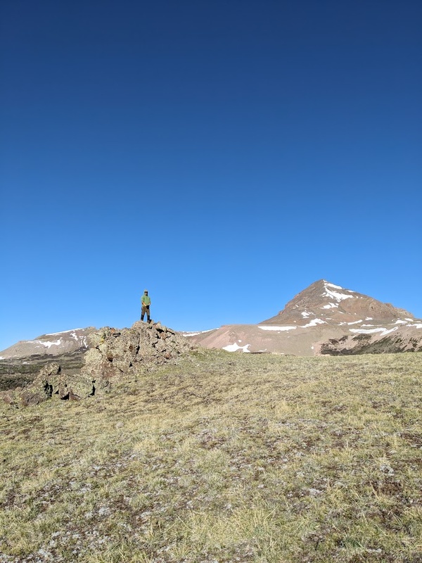
Thanks for your time and staying with me on my unconventional approach through the Centennials! As spring turns to summer, the next leg of the Quest would have me navigating a whole new set of seasonal conditions: summer crowds on the 14ers, more backpacking, climbing through wildfire smoke filled skies, battling blood thirsty mosquitos (and porcupines, as it turns out) and a whole heck of a lot more ridge traversing in the Weminuche and beyond. Until next time, stay safe and have fun in the mountains! GPS Track(s) on Google Maps (made from a .GPX file upload):
View Map
Thumbnails for uploaded photos (click to open slideshow): 


|
| Comments or Questions | |||
|---|---|---|---|
|
Caution: The information contained in this report may not be accurate and should not be the only resource used in preparation for your climb. Failure to have the necessary experience, physical conditioning, supplies or equipment can result in injury or death. 14ers.com and the author(s) of this report provide no warranties, either express or implied, that the information provided is accurate or reliable. By using the information provided, you agree to indemnify and hold harmless 14ers.com and the report author(s) with respect to any claims and demands against them, including any attorney fees and expenses. Please read the 14ers.com Safety and Disclaimer pages for more information.
Copyright: Route information, text, risk factors, maps, GPX files, charts, photos, 14ers.com-created map imagery, flythroughs, and other content provided in this route description are copyrighted by 14ers.com and may not be copied, reproduced, republished, distributed, modified, or used to create derivative works without prior written permission.
Please respect private property: 14ers.com supports the rights of private landowners to determine how and by whom their land will be used. In Colorado, it is your responsibility to determine if land is private and to obtain the appropriate permission before entering the property.